Data Processing
Geophysical data is initially processed in the field immediately after landing using Geosolutions extensive proprietary data processing software. This ensures that quality control is of the highest standard.
Fully processed data and a written report is normally forwarded to the client within 7 days of completion of the survey.
The image below shows the data from a HeliMag survey in South Australia. The survey was flown utilizing a Robinson R22 helicopter in 2006.
Fully processed data and a written report is normally forwarded to the client within 7 days of completion of the survey.
The image below shows the data from a HeliMag survey in South Australia. The survey was flown utilizing a Robinson R22 helicopter in 2006.
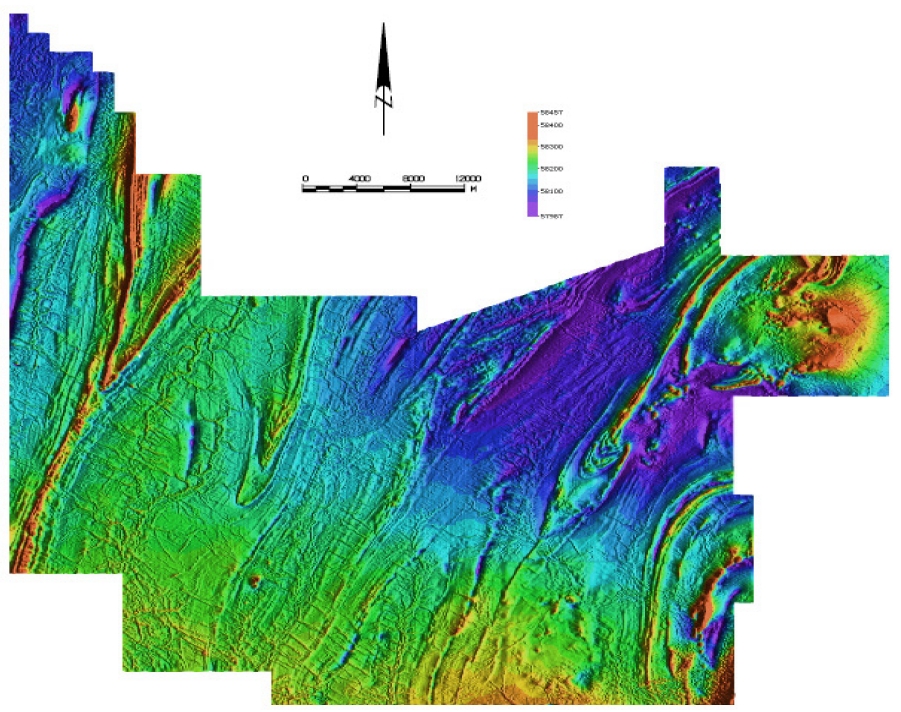
Note the north-west / south-east trending dykes which are less than 1 Nano-tesla in amplitude
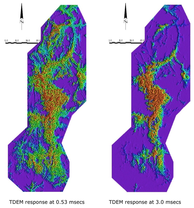
The images below show data collected on a large (>15,000 line km) REPTEM survey in Western Australia during 2008. The early time image on the left shows much greater detail than the later time image on the right.
The area contains numerous salt lakes and associated drainages which appear as the predominant response in the 3.0 msec image.
Geological features not associated with the drainage system can easily be interpreted from the early time image.
The area contains numerous salt lakes and associated drainages which appear as the predominant response in the 3.0 msec image.
Geological features not associated with the drainage system can easily be interpreted from the early time image.